I ended up spending 2.5 weeks in Bend, Oregon. There is a lot to do in the area. In fact I have so many pictures I am going to do this in 2 posts.
I went to Newberry National Volcanic Monument a couple of times. The picture below is Lava Butte. You can drive or hike up the butte. Of course I took the easy way and drove up and then did a small hike up top.
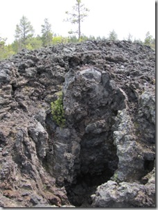
 Something a bit different was the lave cast forest. Its basically more lava, with some “cast” or “molds” of some of the trees that were there when the lava flowed through.
 I was excited to go to the Obsidian flow trail. I was looking forward to seeing the obsidian. It didn’t take long to see some of it.
 I have to admit that I wasn’t quite prepared for what I found on this hike. I think the weather was in the low 60’s when I hiked, but I keep forgetting that at higher elevations they have something I’m not used to -
 Yes, that’s me in my hiking sandals in the snow. The first patch was probably only about 10 feet long, so I carefully walked across it – it was cold. Then around the corner there was much more. I turned around!
One of the local state parks was Smith Rock. This was a neat park, where I did a small hike. The scenery was great.

Where I stayed was closer to Sisters, Oregon, but had an address of Bend. There were 3 “sisters” mountains (I also found out that there was at least one brother, husband and I think either mother or wife)
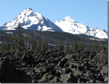
Above is 2 of the sisters (with a lave field in front of it), I’m not sure which one – I think Middle Sister and North Sister. Below is a picture taken when the clouds appear to be blanketing one of the sisters.

One day, I took a long drive to Crater Lake national park.
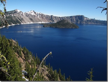
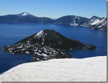
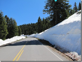
As you can see there was still snow around. In fact only half of the road around the lake was open.
There are several scenic byways in the area. The McKenzie Pass-Santial Pass Scenic byway just opened at the end of my trip. I took several hikes in this area. The picture below is of Proxy falls, to get there you hiked through a lava field.
 Some of the wildflowers were blooming when I went. I saw an orchid that I later identified as a Mertens’ coralroot orchid. It’s not a showy orchid, but just finding and identifying it was fun!
Sahalie Falls is another falls in the area. It’s not far from the road, as is Koosah falls, but there is a trail that is between the 2 that I took. The river was beautiful in this area.
Sahalie -
 Koosah -

Continued in part 2---


