Saturday, October 8, 2011

Munising, MI–Part 2–Picture Rocks Cruise

One afternoon I took a Cruise along the Picture Rocks National Lakeshore.  All pictures in this blog were taken from the boat. 

A view of Miner’s Castle from the water -

mun_pr_cruise2

The colors are produced from various things.  The only one that I remember is that the blue comes from copper.

mun_pr_cruise3_colors

mun_pr_cruise3_colorsamun_pr_cruise7_colors2

mun_pr_cruise5

mun_pr_cruise6

Indian Head Rock is below -

mun_pr_cruise8_indian

Another cruise boat at Petit Portal -

mun_pr_cruise4_boat

Below is Cathedral Rock.  If you look closely you will see that the roots on the tree actually are attached to the rock next to Cathedral Rock.

One cruise a day goes a bit further down the lakeshore to Spray Falls.  Of course I took that cruise!

mun_pr_cruise10_spray_falls

My next blog will be the last Munising Blog.  It will be about my hikes along the Lakeshore Trail in Picture Rocks National Lakeshore.

Munising, MI–Part 1

My next stop in the Upper Peninsula was Munising, Michigan.  This area is home to Pictured Rocks National Lakeshore.  I have been here before, but just for a quick day or 2 stop.  This time I stayed for a week at the Munising Tourist Park which is on Lake Michigan.  Below is a picture taken at the campground of a dog enjoying a day at the beach!

mun_dog_lake

I took a lot of pictures while here, so I will have to break this into multiple blogs.   While in Munising, I took a cruise, went on many hikes and enjoyed several beaches. 

I visited Miners Castle several times during my stay.  When I saw this years ago, it had one additional “turret”, but it fell off several years ago.

mun_pr_miners_castle_1 

mun_pr_miners_castle2

The color of the water is an amazing blue and so clear you can see the many rocks below the water. 

Below is a shot of Miner’s Castle taken in the morning -

mun_pr_miners_castle_morning

A close up view of Miner’s Castle and Grand island in the distance -

I visited several waterfalls in the area.  The first is Miner’s Castle Falls.

mun_pr_miners_castle_fallsSable Falls is another waterfall I visited.  I actually visited this one twice.  On this trip, I found I really liked the town of Grand Marais (about an hour drive east of Munising), so a week later I ended up camping in Grand Marais and about a mile down the beach from my campground was a short trail that went to this same falls.  I’ll blog about the Grand Marais trip later. 

mun_pr_sable_falls

Wagner Falls -

mun_wagner_falls

Grand Sable Dunes is an area between Grand Marais and Munising.  I did a bit of hiking around the dunes. 

I saw a strange looking berry and found out that it was a Wild Dune Cherry.  I was told you could eat them, so I tried one.  At first I thought they were great, but within a second it turned extremely bitter. 

A road sign that I never saw in Georgia!!

My next blog will be pictures that I took on my cruise.

Menominee, Michigan

Yes, I’m still traveling --- just way behind on my blogging.  I am going to try to catch up in the next couple of weeks.  Just so you know, I am slowly making my way back south. I left Michigan about 2 weeks ago.   I will be headed to  North Alabama tomorrow to check out a couple of state parks, then back to Georgia for a while.

After Iron River I headed down to Menominee, MI. While there, I stayed at River Park Campground.  This campground is on the river that divides Michigan and Wisconsin.  Every morning I would walk to Wisconsin!! That sounds better than saying I took my typical 3 – 5 mile walk. This is the bridge over the river headed towards Wisconsin.  The campground is on the left and you can just make out my RV. 

men_bridge

On my morning walk, I walked along the River and saw some great homes, mostly Victorian.  One of them was pink and every time I walked by I thought it looked like a home for Barbie.   The color is a bit off in the picture the home was very pale pink, with pinkish/lavender trim.

men_barbie_house

While there I did a bit of light hiking and bike riding, and also took my car to the shop in Green Bay, Wi.

My next stop was Munising, Mi – home of Pictured Rocks National Lakeshore.

Friday, August 19, 2011

Iron River, MI

In Iron River, I stayed at the Iron River RV park.  It is a city park and just beside the Apple Blossom Trail – a multi-use trail.  I walked 4 miles most mornings on the trail.  The picture below was taken from the trail, just a few feet from the campground.
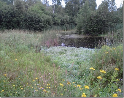
ironr_trail_view

I got a quick laugh over their “pet sign”.

ironr_trail_sign

There are more waterfalls in the area and some good hiking.  One day, I went to the Sylvania Wilderness which is in the Ottawa National Forest.  I was a bit concerned when told that the trail wasn’t marked that well.  It is a 8-mile hike around the lake, but I figured as long as I kept the lake on my left I would eventually make it around.  I did have a map and noticed that part of the trail left the lake for a while.  During that time I got a bit concerned that I had somehow gotten on the wrong trail (there were supposed to be a couple of intersections that I never saw).  But I managed it ok.  I did lose the trail a couple of times, but my theory of keeping the lake on my left worked.  I was hoping to see some Loons and as soon as I got out of the car, I heard them.  I was lucky that they were still fairly close to shore when I got to the lake.

On the trail, I saw some Indian Pipe and an interesting plant that covered the ground in some areas-

ironr_clark_lake_moss

I spent a few minutes relaxing by the lake before finishing up the hike. 

ironr_clark_lake_lake

Another interesting hike was Piers Gorge.  This gorge was formed by the Menominee River. 

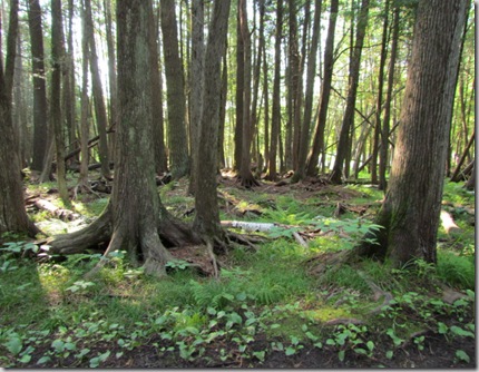
Many of the trees seemed to stretch out at the bottom and hold onto the ground.  I’m sure it has to do with the type tree or soil or something, but I thought it was interesting.

I found the green fungus intriguing.

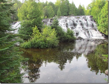
More Waterfalls---  Bond Falls is a beautiful waterfall with very little walking to get there.  I got there very early in the morning for hopefully some good shots.  It is so wide that I couldn’t get a decent picture in one shot and I have a fairly wide angle lens.

Bond Falls – right side (note the morning mist) -

Left side -

Below is the best shot I could get of the full falls.
ironr_bond_falls_all

They had built some stairs that took you up to the top, but the stairs were so close to the falls that the water had started running over the stairs.  A bit slippery, but made for an interesting view from the side of the falls. 

ironr_bond_falls_side

I also went to Agate falls, but the trail didn’t really get to a good view of the falls.  While at the Ranger station, I asked about it and a ranger told me that I would have to jump the fence to get a food view.  I thought it was funny that a ranger would suggest I jump the fence. 

On the same day as Bond and Agate Falls, I went to O Kun de Kun Falls.  But I didn’t make it to the falls.  The trail was extremely overgrown and I wasn’t in the mood to go very far down the trail.

If anyone goes to the Upper Peninsula, 2 great websites are - Hunts upguide and Great Lakes Waterfalls and beyond.

From here I head down to Menominee, MI.

Baraga, Michigan

As I mentioned in my previous blog, my next stop was Baraga.  This was originally just supposed to be a quick stop at a place with full hook-ups ($20.00 for Full Hook-ups and Cable, but basically in a parking lot), but I read about some hiking nearby so I checked it out. 

My first stop was to Sturgeon River Gorge Wilderness.  Of course the highlight was Sturgeon Falls, but just before I got to the falls I spooked a Bald Eagle (actually he spooked me!).  He flew about 15 feet in front of me.   Even though I‘ve seen quite a few Eagles in my travels, it’s still exciting to see one!  Quite often on hikes you see signs saying what can or can not be on the trail – bikes, atvs, horses…  But I had never seen this one --

bara_sturgeon_falls_sign

Hang Gliders – While this is a gorge, I didn’t really see a place for hang gliding!!

Sturgeon Falls -

bara_sturgeon_falls_4684

My next stop was to Canyon Falls.  This is a hike that is also a rest area at the trail head.  Which makes the hike a bit more crowded than I like.  But it is a beautiful place.  I first hiked this mid-day and that’s typically not a good time to take pictures.  The first picture below is from that day.  Then I went back about 7:00 am to get pictures before the sun was high.

bara_canyon_falls_4726

bara_canyon_falls_4813

While the blue sky is nice, I like being able to see the rocks and the falls!  To my surprise, the trail continued on.  Most people turned around at the waterfalls and I think missed some great scenic views.

bara_canyon_falls_4744

bara_canyon_falls_4828


bara_canyon_falls_4767

Next stop Iron River, MI

Saturday, August 6, 2011

Copper Harbor, MI – Fort Wilkins State Park

My next stop was Fort Wilkins State Park in Copper Harbor, Mi.  The campground is on a small strip of land between Lake Superior and Lake Fanny Hooe.  I could see Lake Fanny Hooe from my site, even though I was one row from the lake. 

The above picture was taken from Brockway Mountain Scenic drive.  It shows the strip of land between the 2 lakes that I just mentioned. 

Several mornings, I used their 2-mile loop trail as my morning walk.  This way I walked beside both lakes and through the woods – a nice way to start the day.

One cloudy morning -

ch_lake_am_walk

More pictures of Lake Superior from the campground -

ch_lake_sup1

While driving around the area one day, I happened to see a bald eagle on some rocks in the lake.

Then at a roadside park, I was surprised to see this -

Scuba divers. 

There is a bakery in one of the small towns called Jampot, it is run by the monks from the Catholic Monastery of the Byzantine rite.   I believe this is the Monastery, which is just down the road from the bakery.  

The State Park is an old fort.  As I’ve mentioned before I’m not really into history, but I was here so I visited.

This isn’t what I think of as a typical fort, but this was built to keep order in the Keweenaw Peninsula. 

I was looking at the fence and wondering if the sharpened fence post would really keep anyone out. 

I visited another mine, this time the Delaware mine.  As you can see in the picture below the level just below the one I toured is flooded.

The older buildings are not as well preserved as the one I visited the week before.

Another day I hiked a trail in Estivant Pines.  I really enjoyed the hike, but really never saw anything great.  The only picture I took was the one letting me know where I was -

While on the hike, I started thinking about hikes.  Sometimes I enjoy hiking to see one (or more) scenic areas like waterfalls or rock formations, but this was enjoyable just because it was a nice walk in the woods.

From here I headed back south (I’m as far north as I can go!).  I stayed at a casino in Baraga for a couple of days, just to run errands and then headed down to Iron River where I currently am.

I will blog about that later.