Thursday, May 28, 2015
Bar Harbor and Acadia National Park - part 2
While in Bar Harbor, I went for a bike ride on some of the carriage roads that John D. Rockefeller Jr started in 1913. These roads are about 10 feet wide, but only walkers/runners, bikers and horses (with or without carriages) are allowed on these roads. They are hillier than I am used to since most of my bike rides are on rail trails. I ended up riding about 8 miles, with most of that on a trail that goes around Witch Hole Pond (which is supposed to be the easiest trail) and a short part of the Eagle Lake trail. I had hoped to ride more, but the hills were tougher than I thought. The following day, I could feel it! Below are pictures of the carriage road trails and views from them.
I am guessing that the picture below is why it is called Witch Hole Pond?? Dead trees??
One of many interesting bridges on the carriage trails--
Another trail I hiked was Valley Trail (which was at the same area as Beech Cliffs that I wrote about in part 1). When I talked with a ranger, he would not tell me why he thought I should hike it. He just wrote "WOW" on the map he was writing on for me. I loved it!
You can see the high rock cliffs in the background of the picture below.
That may be too many rocks ,ferns and moss for some of you but I loved it and could not decide which pictures to post. Believe me, I have many more!!
One day, I drove up Cadillac Mountain and walked around up top for a while.
I also visited Bass Harbor Head Lighthouse, where if the sign is correct a Coast Guard Family still lives in it. It was hard to get a decent picture of it. You can see the red light in the lighthouse, it was foggy that day, so I waited for the light to come on to take the picture
From Bar Harbor, I headed into Canada where I am sitting in my RV because it is extremely foggy in St. John, New Brunswick. So foggy that I got a bit wet just walking outside for a couple of minutes.
Bar Harbor and Acadia National Park - Part 1
Can you believe it?? I am actually not behind in my blogging. It has always been my plan to post the blog as soon as I leave the area and I just left Bar Harbor yesterday!
I was in Bar Harbor May 20 – 27 and had a great time. The weather was a bit cold and a few times rainy and/or foggy, but I would rather it be cold than hot.
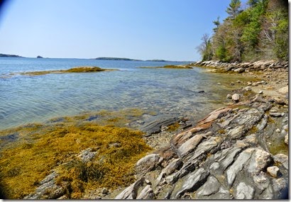
As my few readers know I love rocks and I love water, especially the coast. So the Maine coast was great! Below are some shots that I took while rock hopping on some stops along the loop road in Acadia National park.
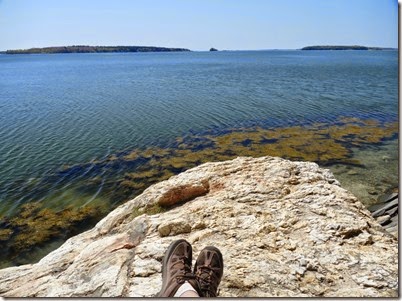
A couple of shots of me relaxing and enjoying the view --
I have found the panoramic shots look better if you click on them to enlarge it.
I hiked several trails while there. One of my favorites was Beech Cliffs. It is one of the shorter trails, but I loved it so much I did it twice. The trail starts of heading up a hill in a wooded area and then I came to the view in the first picture below. I knew I was going to like it at first sight. Then up and over the rocks and wow!
The picture below shows Echo Lake below the cliffs and off in a distant is the Gulf of Maine.
The shot below is looking the other way, with a view of the trail, which climbs the rocks in the upper left corner and Echo lake down below.
The trail was great, it included a bit of rock climbing and some fantastic views!
Another short trail I hiked was Wonderland trail. It lead to the shore in an area known for it’s tide pools. I enjoyed it and was hoping to find a sea star, but didn’t.
While there, I stayed at Mt. Desert Narrows RV Park. It is a private park that is ok. The restrooms were a bit dingy (old, but clean) and for wi-fi I had to walk up to the community building. But the view I had made up for everything. The campground was located along a basin (I think it’s Thompson cove, but I can’t find that map!) in the gulf. I enjoyed watching it at different times as the tide changed. The first picture was taken with my phone on my last night there. (so no fancy camera to change the colors). The second is a panoramic shot taken at close to high tide. At low tide most of the area in the photo was dry (well muddy).
I took so many pictures I will post the others in part 2.
Tuesday, May 19, 2015
The rest of Freeport, ME
Note – this is my second post of the day, I typically don’t do that, but but now that I have limited internet access I will post when I can.
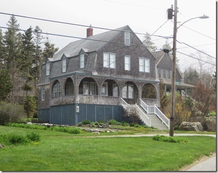
One day, I took a driving trip to see some of the coast and small coastal towns. Ocean’s Point was the first place I stopped. The homes were really interesting and some of them had a nice view.
Ocean’s Point --
Then I headed to Pemaquid Point Lighthouse Park. It was only 6 miles from Ocean’s point, but that is only if you can fly. By car, it is about 40 miles.
The lighthouse -
It was a little bit foggy when I first got there, but I had some sun.
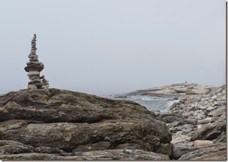
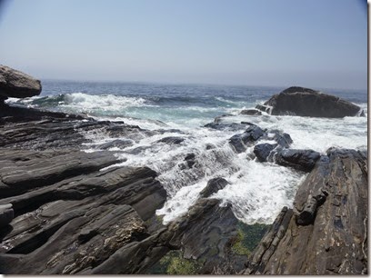
Pictures from the area --
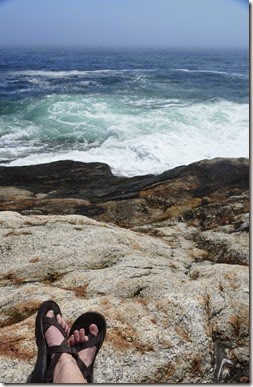
Once again, I found a great spot to sit and enjoy the view. Watching waves hit the rocks and watching the fog roll back in was great. After a while I wanted to applaud for the great show I had seen, but I didn’t as the people around me might have thought I was crazy (and the great show was still going on!).
Other pictures from the area --

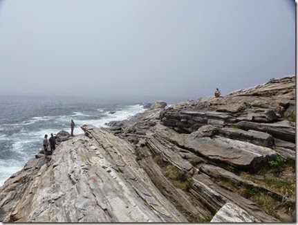
 A beautiful area, I ended up spending a couple of hours there walking around the rocks and enjoying the views. I probably would have stayed longer, but it got so foggy that I could feel my clothes getting wet.
I can’t believe that by finishing this up I am ahead of schedule for blogging. Tomorrow on May 20, I head to Bar Harbor for a week.
Georgia to Maine
This blog is going to be a summary of my trip from Georgia to Maine (late April to now).
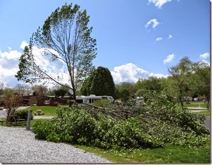
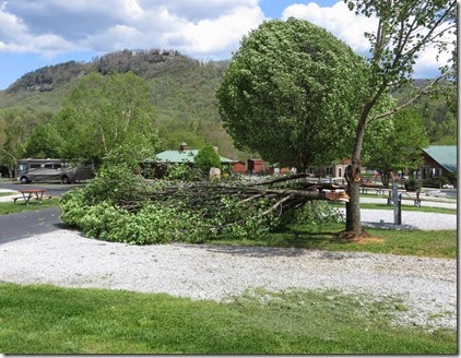
I forgot to post a picture of the campground I stayed at while in Dillard, GA. We had a couple of bad storms and the campground has quite a few Bradford Pear trees, which are beautiful. But they are a very soft tree and when they get 12 to 15 years old they tend to break very easily. Luckily no RVs were hit when they broke and the campground is having someone look at the others to see which trees should be taken down.
That is my RV behind the broken tree, but there is one empty RV spot between the tree and me! The tree below was on the other side of my RV. A RV had left this spot about an hour before this one fell.
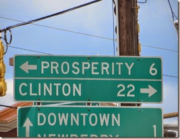
From Dillard, I headed to Spartanburg, SC where I got my RV washed and waxed. While it was being done, I headed down to Newberry, SC and bought some Dowd’s BBQ hash that I was raised on –yumm!!! For those not familiar with this, it is not like the hash that comes in a can. It is basically BBQ pork in a sauce (South Carolina BBQ sauce is mustard based), and I like it served over rice. I froze several meals worth!! While there, I spotted the sign below. This sign (or one like it) was shown several times during the Bill Clinton Presidential race, I wonder if it will show up for Hillary? I may have posted this a few years ago, but whenever I see it, I get a laugh.
Prosperity one way, Clinton the other way!!
From there, I slowly made my way to Wellsboro, PA. I made a few stops on the way, but nothing too exciting.
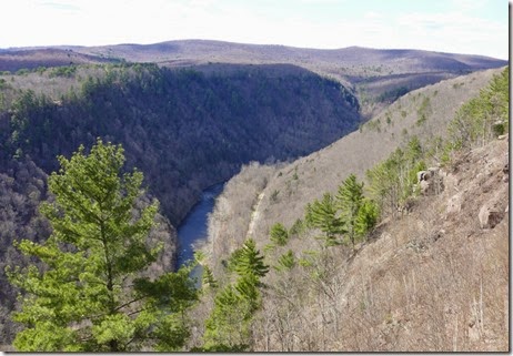
A few years ago, I learned about and rode my bike on the Pine River Gorge Rail Trail and really enjoyed it. Since it wasn’t too far out of my way, I decided to go back. I ended up riding 3 of the 5 days I was there. I rode from 15 – 20 miles each time.
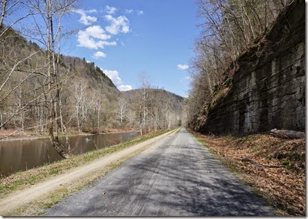
The picture below is of the gorge, you can just make out the trail just to the right of the river.
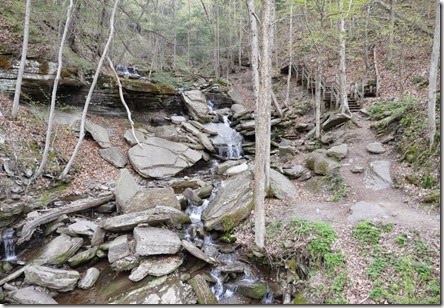
Typical scenery from the trail through the gorge--
Turkey Run --
More scenery from the trail --
I had thought that after Wellsboro, I would head to Watkins Glenn State Park in New York. I went here several years ago and loved it. Fortunately a few days before I was going there, I checked their website where I saw that only about half of the main trail was open. They were still working on Winter storm cleanups. After doing some research, I decided I did not want to go unless it was all open. Maybe I will go there on my way back south this fall.
In looking at my route to Maine, I decided to stop in Littleton, Mass. This is about 40 miles from Boston. I had thought I might take one of the touristy sightseeing tours of Boston, but didn’t, I’m not really into history so I would have to be really bored to do that. The thing that interested me most about the trip was seeing the “Cheers” bar.
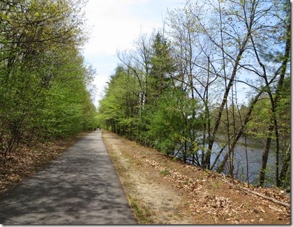
The campground was about 5 minutes from the Nashua River Rail trail. I ended up riding the whole trail (24 miles round trip) twice.
Pictures from the trail are below --
From Littleton, I made my way to Freeport, Maine where I am currently. I don’t have very good internet reception and have reduced my data plan anyway, so will wait until I get to a place with free wi-fi before I post this.
While in Freeport, I did a bit of shopping at LL Bean and 2 other stores, but since I am not into shopping that hour of shopping was plenty for me. After shopping I enjoyed a Lobster roll at one of the local restaurants
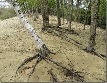
I am staying at Desert of Maine campground. This area is desert-like due to Glaciers (a long, long time ago) and poor farming techniques. They have a tour of the area, but I just walked around it a few times.
Note the roots, those trees have to work hard to live in this glacial silt.
The barn below is more than 175 years old and is the only building left from when the area was a farm.
I also visited Wolfe Neck Creek State Park where I got my first look at a little bit of rocky shore line. I had planned on walking several miles, but ended up only walking a couple of miles as I found a great spot to sit, relax and think about all kind of things!(the last picture was taken at this spot)
One day, I drove to Ocean’s Point and Pemaquid Point Lighthouse park. But I took so many pictures that I will post another blog for that.
This is my last full day in Freeport and it is raining, so I am currently sitting in the library enjoying the nice facilities and the wi-fi.


